There are over 4,500 sheep and beef farms on hill country in New Zealand, making up a significant proportion of New Zealand’s pastoral production. Hill country, however, is largely unsuitable for most traditional farming machinery. Before the commencement of the programme in 2013, farmers would distribute fertilizer predominantly via pilot-initiated manual release aircrafts, with only the variation of the hopper door discharge as a means to reduce or increase the amount of fertiliser distributed. It is widely acknowledged that this practice results in over-fertilising and wastage in some areas, under-fertilising and poor growth in others, and an incomprehensive system for controlling the discharge of nutrients into waterways.

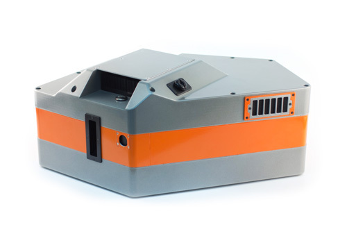
Ravensdown’s Pioneering to Precision Primary Growth Partnership Programme aims to establish efficiency in the distribution of fertiliser through the introduction of computer-controlled fertiliser delivery, driven by a Geographic Information System (GIS) map of the land that is fed data from airborne hyperspectral sensors. To achieve this, SPECIM Fenix Hyperspectral sensors are mounted in a single-engine, fixed-wing aircraft and deployed across hill country farmland. The raw data acquired from these flights are then processed using GEONA Hyperspectral software to ensure an accurately radiometrically calibrated and geolocated dataset is achieved. The entire process of converting sensor data to a mapped product has been completely automated and deployed in a cloud computing environment for increased capacity and speed, and GEONA Hyperspectral plays a key role in this process. Prior to the use of GEONA Hyperspectral, the time required for the radiometric calibration and mapping operations for data from a single farm could be measured in hours, or even days, however, now it can be measured in minutes.
The resulting dataset feeds into a GIS map that effectively produces a forage analysis for every square meter of the land, enabling the accurate assessment of the nutrient status. Of course, data validity is a critical factor to the success of the programme, so significant calibration and validation field trials conducted across thousands of laboratory analysed pasture samples and hyperspectral imaging data, have been performed and now form the largest data set of hill country pastures ever taken in New Zealand.
Largely driven by the depletion of natural resources, precision agriculture is increasingly prominent throughout the farming industry, with the technology behind the method now in widespread use across aviation based agricultural applications. The technique enables precise distribution, so crops and soil receive the precise amount they require for optimum performance, sustainability, and profitability, while also protecting the surrounding environment from being contaminated with excess fertiliser.
The combination of gaining the accurate nutrient status of the land and the application of Ravensdown’s precision technology is reducing fertiliser costs per unit while increasing productivity in terms of dry matter and thus stock growth. Challenges that have historically affected the yield of production such as slope, aspect, elevation, topsoil depth, and variable moisture and temperature across the hill country can now be overcome with a fast and accurate fertiliser application that supports maximum production efficiency and sustainability. In terms of financial gains, the programme is on track to deliver a financial benefit to New Zealand of $120 million per annum by 2030 and $293 million by 2050 derived from additional exports of meat and wool due to an average 15% increase in pasture growth.
In the broader sense, Ravensdown’s Pioneering to Precision Primary Growth Partnership Programme is a fantastic showcase of how data acquired from airborne hyperspectral sensors, producing accurate information in detailed map form, can not only revolutionise the approach to large-scale farmland management but can be packaged to form a high-impact high-return socially conscious commercially successful product for use in a broad range of applications.